Satellite imagery for your business, without the GIS degree
Type an address, draw an area, pick a date. Caelus finds the clearest satellite image of that place from any day since 1984 and hands it back ready for your report, your deck or your GIS.
Plans from $30/month. No contract, cancel any time.
What is Caelus for Business?
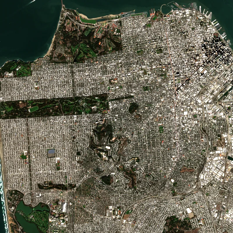
Caelus for Business is a simple web app for getting satellite images of any place on Earth, on any date from 1984 to today. It searches the Sentinel-2 and Landsat archives for you, picks the least cloudy captures, and exports a clean PNG or a georeferenced GeoTIFF of exactly the area you drew. Plans start at $30 a month.
Three steps, a couple of minutes
Find your place
Search an address or coordinates, then draw the area you care about — a parcel, a field, a whole county.
Pick a date
Choose a day or a range. We rank every capture by cloud cover and closeness to your date, clearest first.
Export
Download a colour-corrected PNG for a slide, or a GeoTIFF for QGIS and ArcGIS. Source and date included.
Built for people who need the picture, not the pipeline
Real estate & site selection
See how a parcel and its surroundings have changed over the years before you make an offer.
Agriculture
Track crop health field by field through the season with vegetation index maps.
Construction & insurance
Pull a dated before and after of a site or a claim, from the same satellite, in minutes.
Environment & ESG
Document deforestation, shoreline change, flooding and burn scars with an independent record.
Energy & infrastructure
Monitor solar farms, pipelines and corridors across large areas without sending anyone out.
Journalism & research
Find the image that shows what happened, when it happened, and cite exactly where it came from.
What you get
- Forty years of history. Sentinel-2 from 2015 onward at 10 metres per pixel, and the Landsat archive back to 1984 at 30 metres.
- Clouds handled for you. The same scene picker behind our prints ranks every capture so you never scroll through grey images.
- Before and after. Put two dates side by side, from the same satellite and the same angle, and export both.
- More than a photo. Vegetation, water and burn-scar views computed from the satellite's infrared bands.
- Ready to cite. Every export carries the satellite, scene ID, capture date and the attribution line.
Is it right for you?
Caelus uses free public satellite data, which is what keeps it affordable. At 10 metres per pixel you can clearly see fields, buildings, roads, construction sites, coastlines and flood extents — but not cars or people. If your work depends on sub-metre detail, a commercial imagery provider is the better fit, at a much higher price. If you need dependable, dated images of places and how they change, Caelus gets them to you in minutes instead of hours.
Simple plans
Month to month. Every plan includes the full archive and commercial use of every export.
Starter
For one person who needs imagery every week.
- 1 seat
- 50 image exports a month
- Areas up to 100 km²
- Full archive, 1984 to today
- PNG and GeoTIFF exports
- Vegetation (NDVI) view
Pro
For teams that watch many sites.
- 3 seats
- Unlimited image exports
- Areas up to 2,500 km²
- Before / after comparison
- Saved sites with new-image alerts
- Every index: NDVI, water, burn, moisture
Team
For organisations with their own systems.
- Unlimited seats
- Unlimited image exports
- API access
- Bulk area uploads (KML, GeoJSON, shapefile)
- Invoicing and purchase orders
- Priority support
Questions
Where does the imagery come from?
From the same public archives scientists use: ESA's Sentinel-2 for 2015 onward, and the NASA/USGS Landsat archive back to 1984. Every export records the satellite, the scene ID and the exact capture date, so you can cite it.
How detailed is it?
Sentinel-2 images are 10 metres per pixel and Landsat images are 30 metres. That is enough to see fields, buildings, roads, coastlines, construction sites and flood extents, but not cars or people. If you need that level of detail, commercial providers sell sub-metre imagery at a much higher price.
How often is a place photographed?
Sentinel-2 revisits most of the world every five days. Clouds hide some of those passes, so we rank every capture by cloud cover and closeness to your date and show you the clearest ones first.
The archives are free. What am I paying for?
Time. Finding the right scene in the free tools, downloading gigabytes of bands, and clipping and colour-correcting them takes hours and some GIS skill. Caelus does it in a search box and a click, and the export arrives ready for a report, a slide deck or your GIS.
What file formats can I export?
A colour-corrected PNG for reports and presentations, and a georeferenced GeoTIFF for QGIS, ArcGIS and similar tools. Team plans can also pull imagery through an API.
Can I use the images commercially?
Yes. Sentinel-2 and Landsat data are free to use for any purpose, including commercial work. We ask only that you credit the source, and every export includes the attribution line to copy.
Can I cancel any time?
Yes. Plans are month to month, with no contract, and you keep everything you have already exported.
Be one of the first teams on Caelus
Tell us what you need imagery for. Early-access teams help shape the product, and keep their launch price.
Join early access